
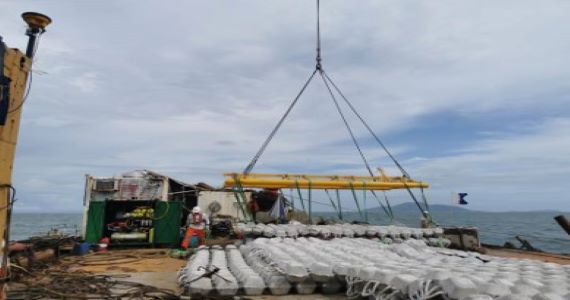
Mattress Laying Monitoring System
During the sinking and discharging process, due to the influence of gravity and various environmental factors, the discharge body will shrink in the width direction after sinking. The real-time monitoring system for sinking and discharging can better assist in completing the operation with high quality.
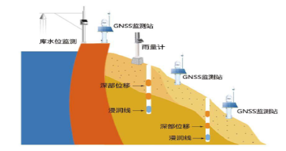
Settlement and Deformation Monitoring System
Settlement and Deformation Monitoring System typically use multi satellite and multi frequency GNSS modules such as Beidou and GPS, which can achieve single system positioning or joint RTK positioning, improving the precision and reliability of positioning.
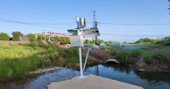
River Monitoring
Using AI cameras and Ultrasonic sensors to intelligently identify water levels and the presence of sediment in rivers during extreme weather conditions, and transmitting the data in real-time to the server.
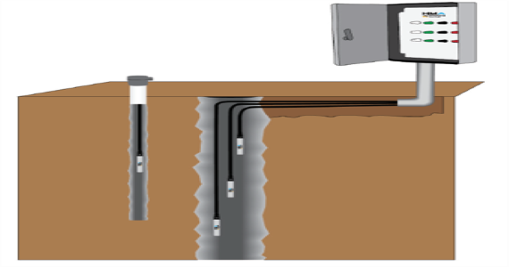
Underground Water Monitoring
Vibrating Wire Piezometer (VWP) is designed for long term monitoring and accurate measurement of pore water pressures in fully or partially saturated soil and rock.
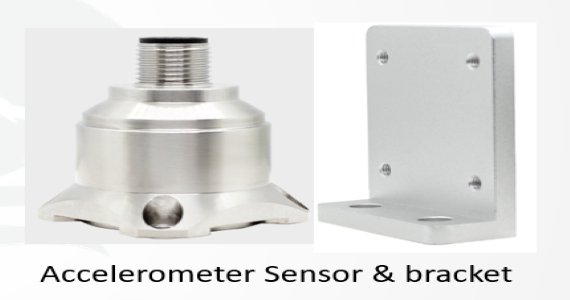
Vibration Monitoring
The vibration monitoring system transmits the collected parameters such as acceleration, frequency, and amplitude to the environmental monitoring host through an acceleration sensor. The environmental monitoring host then transmits the obtained element information values to the backend server through a communication module, establishing a comprehensive monitoring system for rotating equipment.
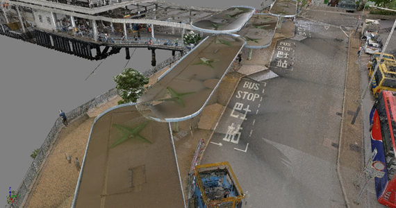
Laser Scanning
Laser Scanning is used to develop 3D scans (or models) of building elevations, floor plans, tunnel profiling and motorway/ rail bridges as well as mapping topography. ESG can build mobile platforms to provide mobile laser scanning services, such as remote controlled wheelchair and moving vehicle.