
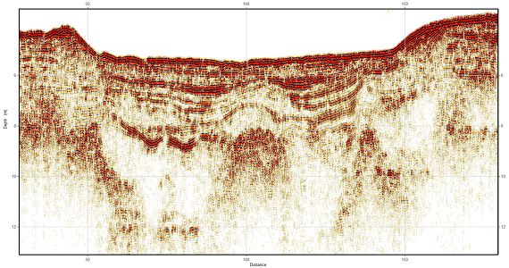
Seismic Reflection Survey
Seismic reflection surveying is a geophysical method widely used in marine oil and gas exploration. It involves emitting seismic waves and receiving their reflected signals at different stratigraphic interfaces, enabling accurate exploration of submarine geological structures.
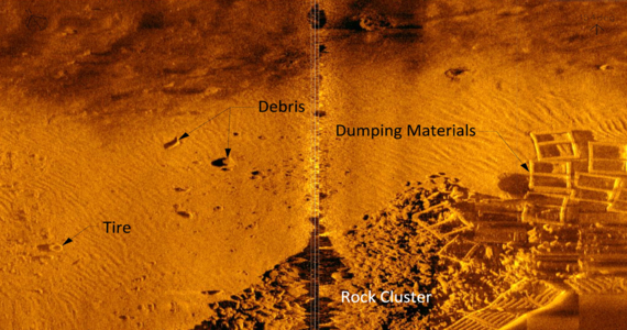
Side Scan Sonar Survey
Side-scan sonar is a powerful underwater imaging technology suitable for various complex underwater conditions, capable of generating high-resolution 2D images of the seabed. Whether for engineering planning, archaeological exploration, or environmental monitoring, side-scan sonar can provide efficient data support for projects.
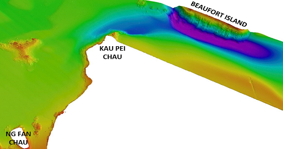
Multibeam Echo Sounder Survey
Multibeam sonar can generate high-resolution seafloor topography maps and is widely used in fields such as ocean exploration. This technology offers extensive coverage and high data accuracy, helping clients gain a comprehensive understanding of the seabed environment, mitigate risks, and provide precise and reliable seabed data support for projects.
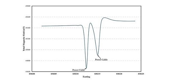
Magnetometer Survey
Magnetometer surveys excel in detecting variations in the Earth's magnetic field, providing valuable insights into subsurface geological features. They help identify potential mineral deposits, archaeological sites, and unexploded ordnance.
Hydrologic Data Acquisition & Analysis
Through advanced monitoring equipment and an integrated data collection and analysis system, a comprehensive understanding of the aquatic environment is provided, offering crucial support for water resource management, environmental policy-making, and scientific research.
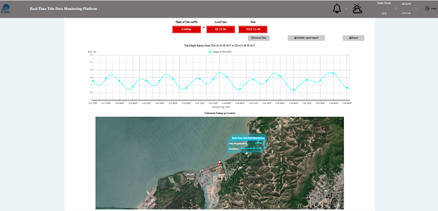
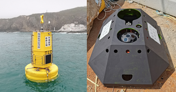
Automatic Tide Gauge
Automatic Tide Gauge can be installed and real-time tide data can be uploaded to the cloud platform for clients to browse and use.