Smart Utility Tunnel Platform
1 Introduction
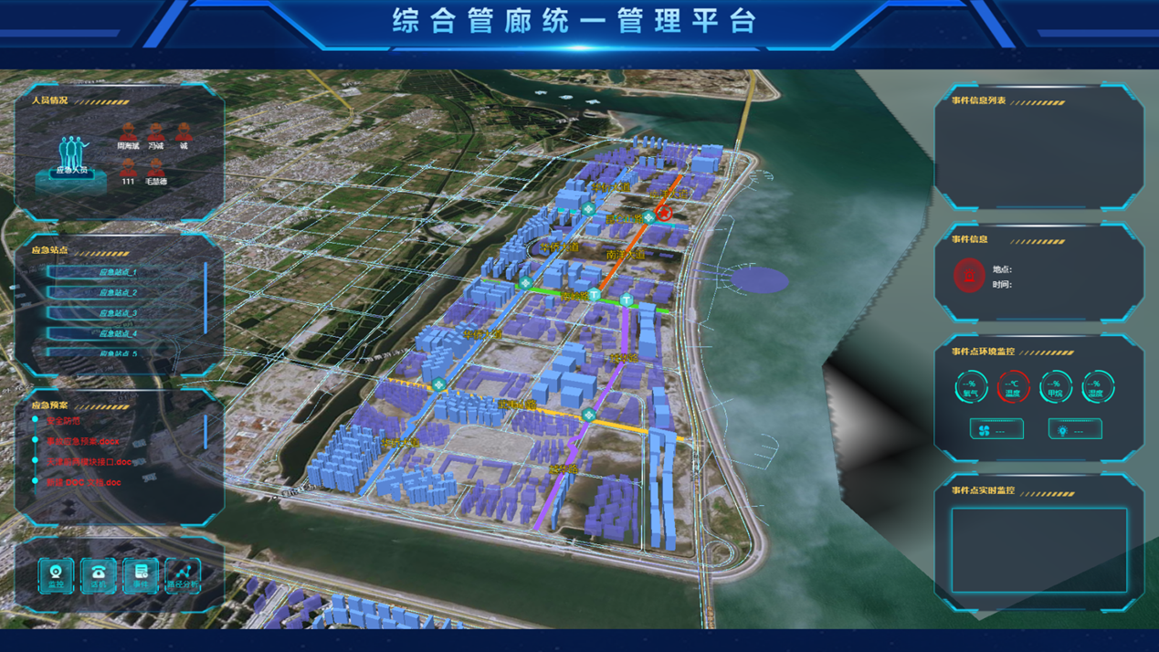
The smart pipe gallery platform integrates the IOT, the Internet, computers, 3D rendering, BIM and GIS technologies to realize the aggregation and integrated management of comprehensive pipe gallery data, and supports the supervision, maintenance, analysis and visual display of operation and maintenance management. It adopts a "dual engine" architecture, provides 3D display, map presentation, dynamic performance, alarm linkage and emergency command functions, and creates a convenient, efficient and professional unified pipe gallery management platform.
2 Platform Features
Visual interaction interface, 3D modeling and simulation technology, to achieve comprehensive visualization and integration of pipeline corridor operation and maintenance management.
Integrate security, automation and other subsystems, and intelligently process multi-source data.
Embedded standardized control process, providing equipment failure handling standards, ensuring data storage and transmission specifications.
Support the actual operation and maintenance business process, establish efficient business process models, and achieve effective management and application of data.
3 Key Functions
3.1 Scenario Simulation
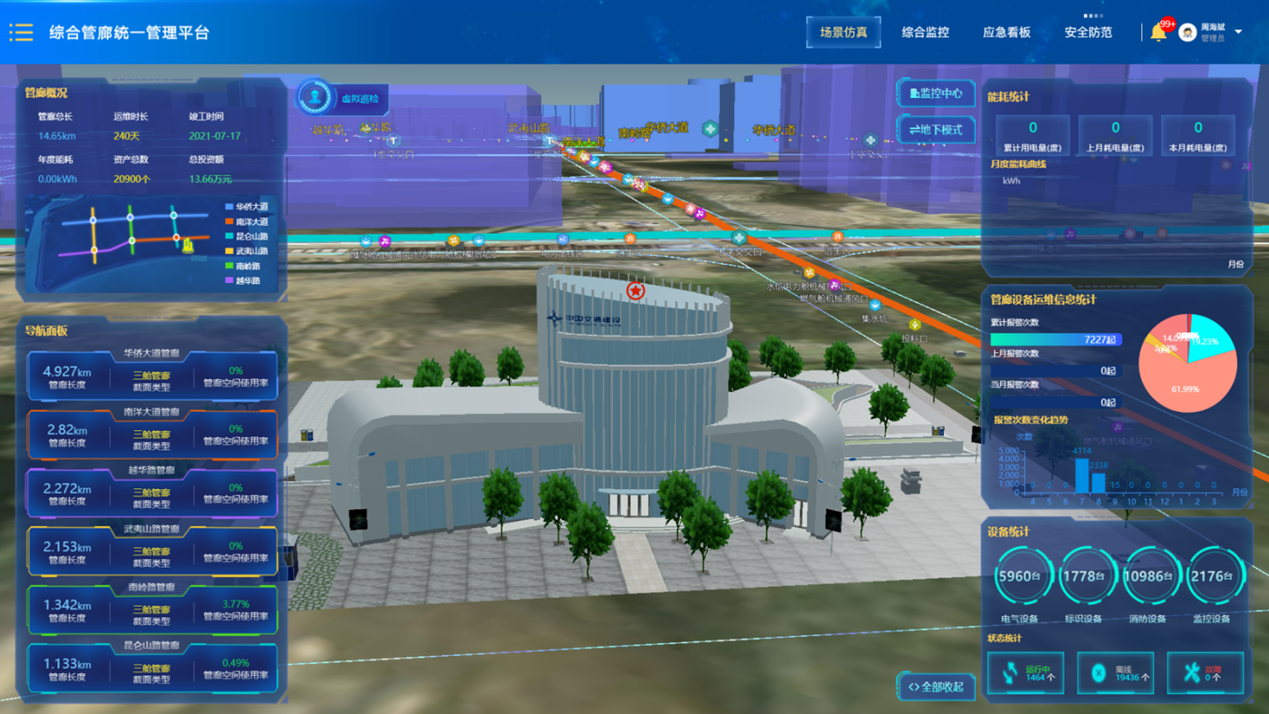
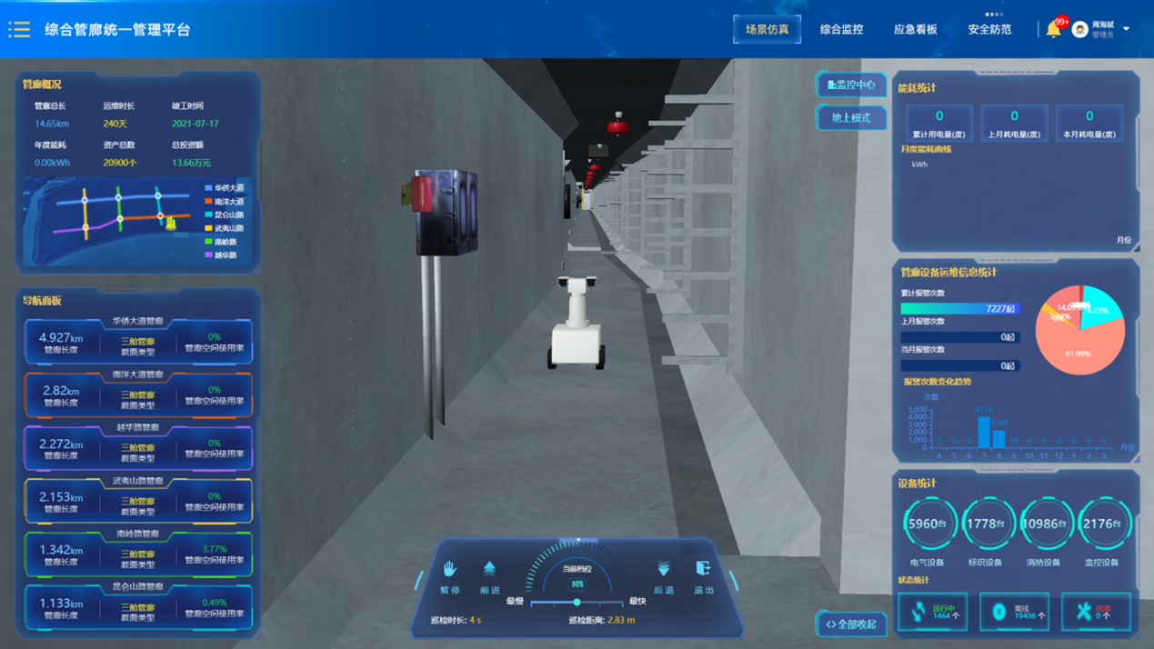
The platform displays the geographic distribution of corridors through a 3D GIS map, providing an intuitive management interface that enables spatial positioning, retrieval, and simulation effects. It also allows users to view the distribution of underground corridors, achieving integrated urban underground space management. The platform utilizes scene simulation technology to simulate a first-person perspective of a robot patrolling, creating a dynamic virtual inspection management platform and offering an interactive control interface and dashboards.
3.2 Intelligent Monitoring
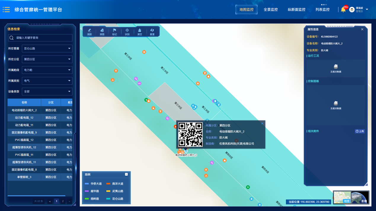
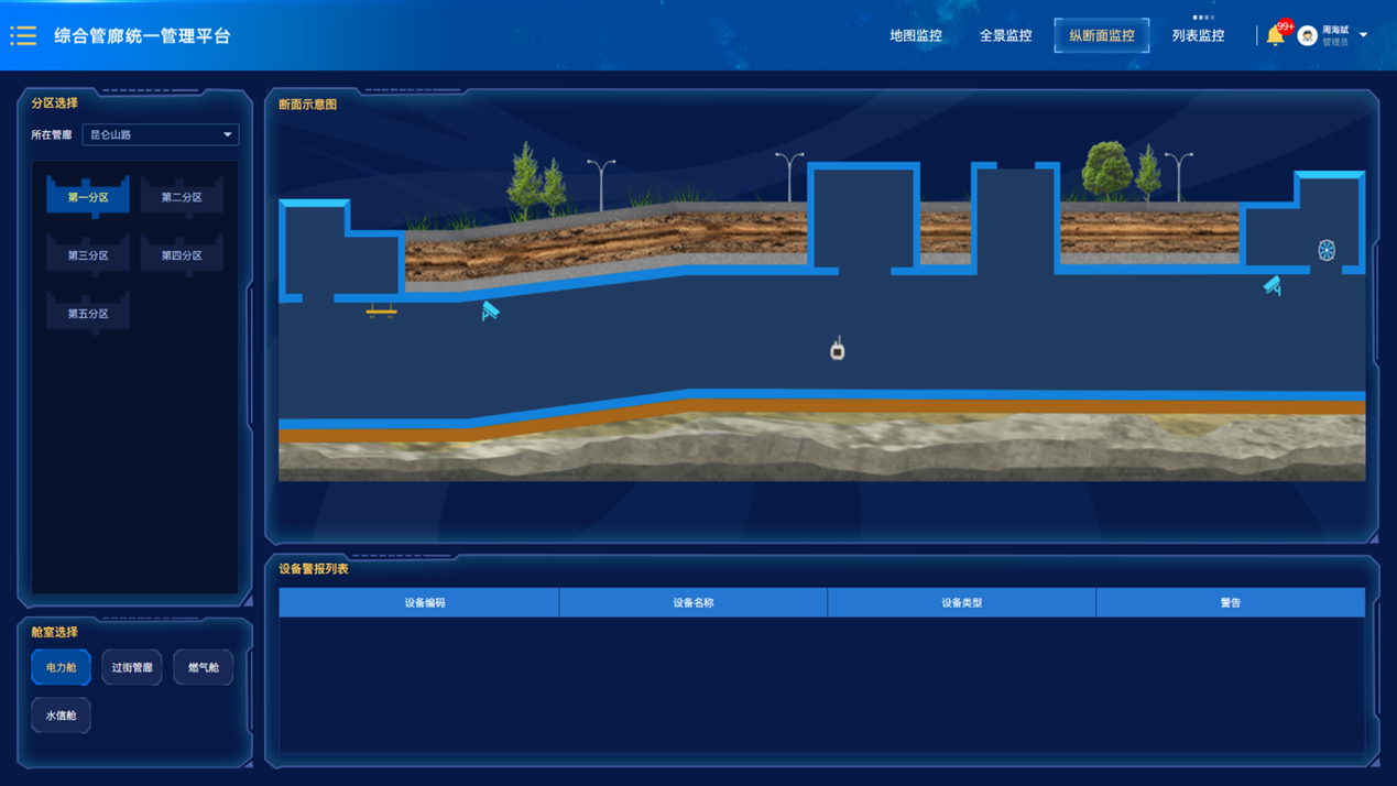
The intelligent monitoring management module provides four-dimensional corridor monitoring modes, and at the same time accurately locates the corridor equipment and monitors the operating conditions and operating parameters in real time.
3.3 Security and Protection Management
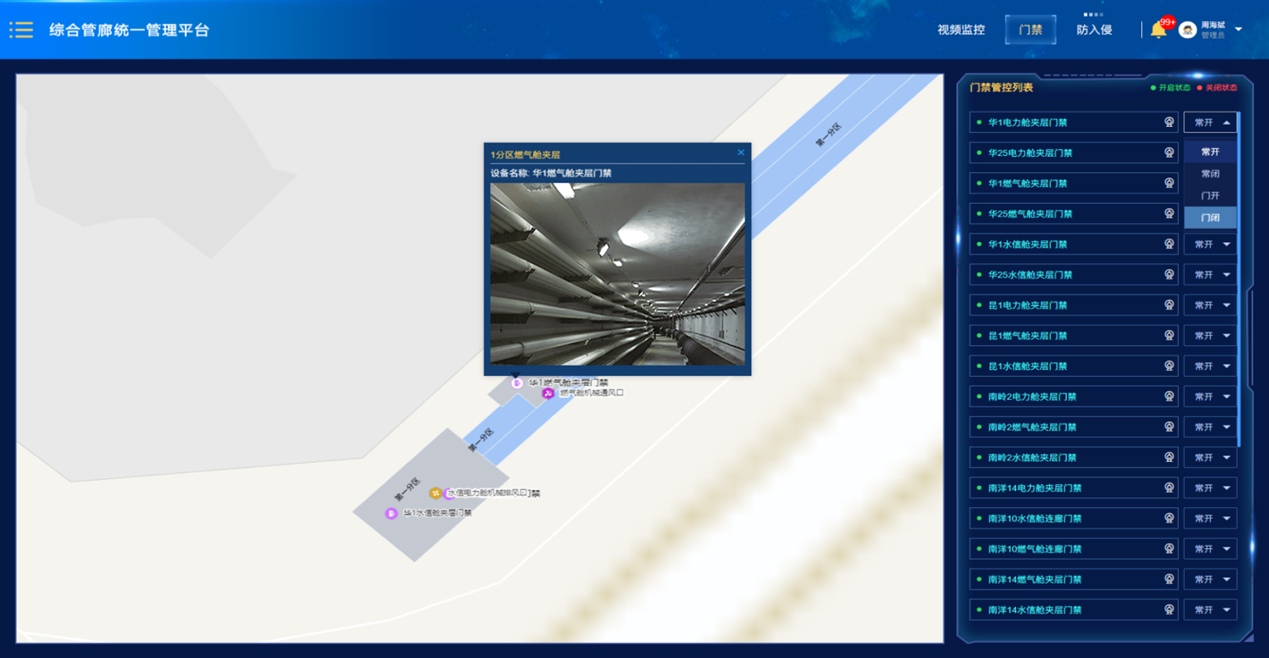
The security management module uses GIS technology to display the geographical locations and related information of all entrances and exits and access control of the pipe gallery in the form of lists and maps, and achieves single-point control of the opening and closing status of each entrance and exit.
The system supports displaying the surveillance camera information list in a partitioned manner. Specific cameras can be located and queried through information such as map location, district, code, name, and responsible person.
3.4 Comprehensive Configuration Management
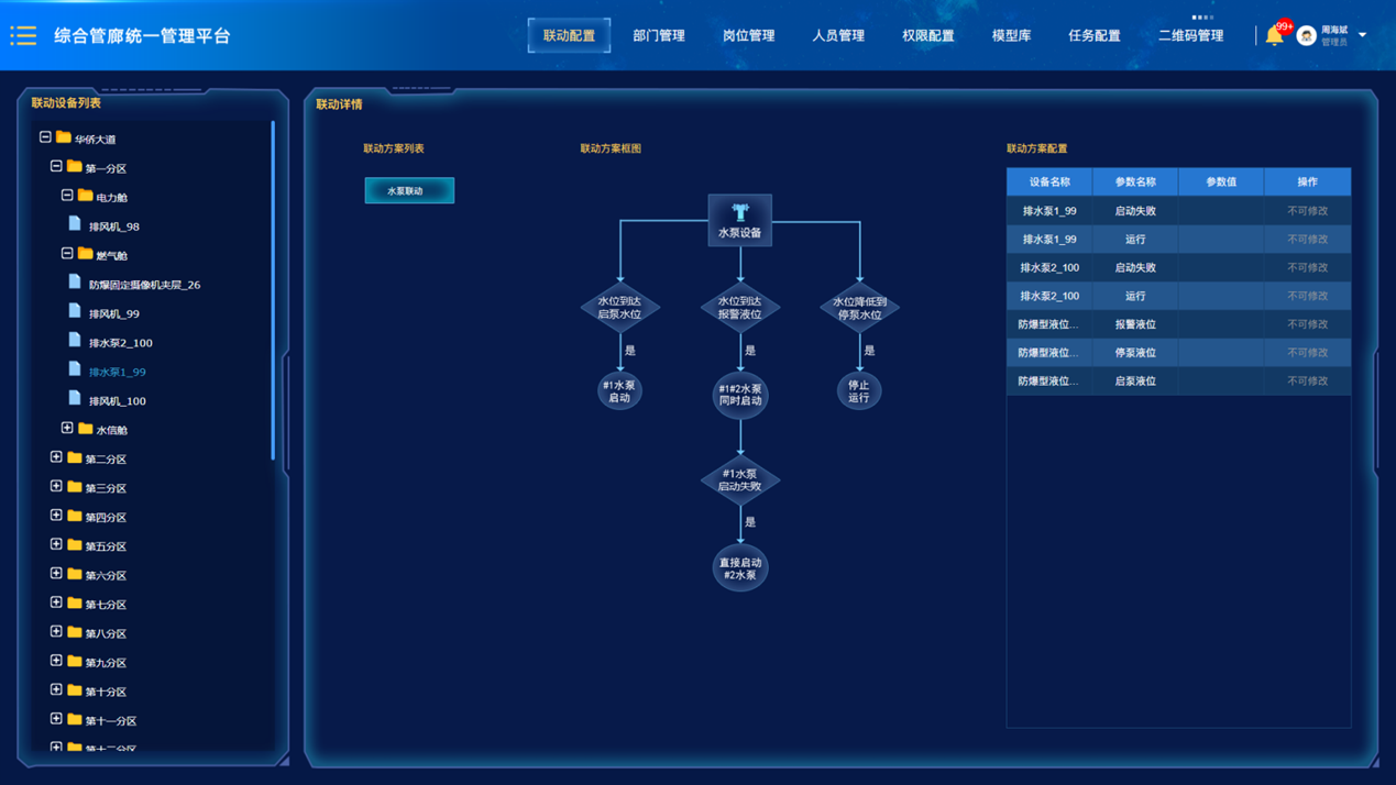
The comprehensive configuration management function is divided into three modules, namely system linkage configuration management, task configuration management and QR code management.
