Digital Geology Platform
Platform Introductions
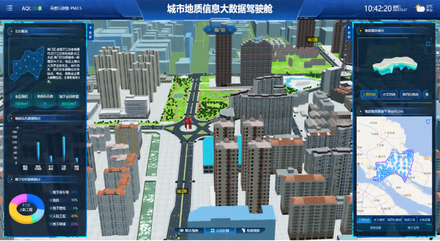
This product is guided by the actual needs of urban geological surveys, with the aim of serving social and economic sustainable development. It revolves around urban development planning, based on existing data and achievement materials, fully integrates cutting-edge technologies such as 3DGIS, BIM, and the Internet of Things, and develops an integrated urban geological information management and service that includes urban basic geology, hydrogeology, engineering geology, geological disasters, soil geochemical quality, shallow geothermal energy, underground space resources, sponge cities, and other data. It has universal functions such as geological information standardization, informatization and systematic management, 3D geological structure modeling, 2D and 3D integrated analysis and evaluation, and information release, providing a standardized, comprehensive, and information-based computer basic work platform for professional technical personnel and managers.

Core Functions
In this module, the city's 3D scene is displayed through the integration of 3DGIS and BIM technology, supporting simultaneous loading of models from multiple regions and cities, as well as quick and convenient scene switching between different regions. On this basis, overlaying bedrock geology, Quaternary geology, hydrogeology, engineering geology Nine sub modules of data, including geological hazards, land quality, shallow geothermal energy, underground space, and sponge cities. Enter different geological topics and display them The drilling data list and geographic information distribution facilitate the acquisition of all relevant information such as basic drilling information and geological information.
Applications
3D Geological Structure Modeling, Comprehensive Analysis of Geological Information

