
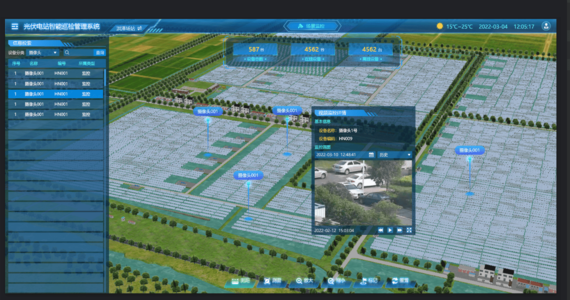
Smart Photovoltaic Power Station Platform
This product is a big data-based smart operation and maintenance platform for photovoltaic power stations, which integrates 3D GIS, BIM, IoT, and 3D rendering technologies to establish a fully autonomous inspection system. It aims to achieve unattended operation, reduce manpower, centralize control, and ensure safe production.
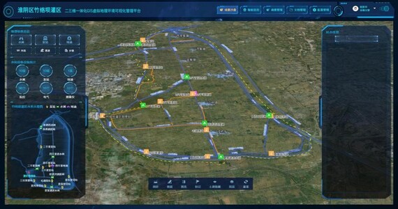
Smart Irrigation District Platform
The Smart Irrigation District Management Platform aims to enhance the automation and precision of water management in irrigation projects. Centered around a digital irrigation district, the platform integrates big data and remote control to build a comprehensive water management system for irrigation districts.
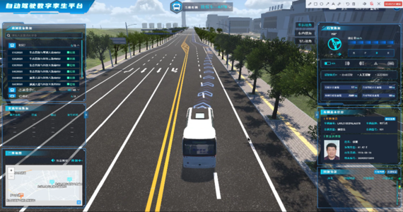
Autonomous Driving Digital Twin Platform
The autonomous driving digital twin platform aims to solve issues in shuttle management, such as inaccurate data and slow response times. The platform can simulate real-world scenarios and vehicles, providing real-time simulations of vehicle operations and surrounding environmental changes.
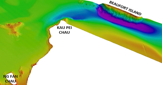
Multibeam Echo Sounder Survey
Multibeam sonar can generate high-resolution seafloor topography maps and is widely used in fields such as ocean exploration. This technology offers extensive coverage and high data accuracy, helping clients gain a comprehensive understanding of the seabed environment, mitigate risks, and provide precise and reliable seabed data support for projects.
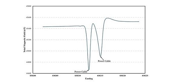
Magnetometer Survey
Magnetometer surveys excel in detecting variations in the Earth's magnetic field, providing valuable insights into subsurface geological features. They help identify potential mineral deposits, archaeological sites, and unexploded ordnance.
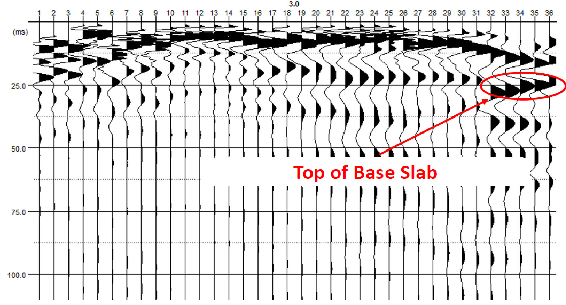
Seismic Mapping
Seismic Mapping obtains the position of underground structures including Concrete Block, Box Culvert, Pipeline, etc.