Port and Shipping Geographic Information Platform
Platform Introduction
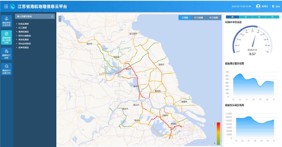
This product can improve the management capability of port and shipping infrastructure and achieve digital management of infrastructure. Enable users to conveniently and quickly query and locate the spatial distribution of port and shipping equipment and facilities, and easily achieve systematic management of various data on increasingly complex port and shipping facilities. In addition, a comprehensive survey and digitization of existing facilities will be conducted, and a "one map" management of port and waterway facility data will be formed based on GIS technology, which can play an important supporting role in the analysis and simulation of waterway freight volume, asset management, and other work.

Core Functions
The statistical query module mainly conducts statistical analysis on various data such as port berths, inland waterways, port throughput, waterway freight, and freight OD. By using keywords and navigation bar search methods, statistical data charts such as bar charts, trend charts, and ring charts can be queried. By combining statistical charts with maps to display the operational status of ports, it meets the needs of users for statistical data and understanding of port and shipping operations.
The situation monitoring module combines charts and 2D GIS maps to display shipping indices, infrastructure capabilities, port busyness, operational efficiency, channel congestion, and other situations, providing overall monitoring of port and shipping operations
Applications
Supervision, Operational Situation Analysis, Equipment Archive

